Pebble Mine Status
Impartial. Educational. Fact-based.
Maps
- PDF Map of land ownership in proposed Pebble Mine area
- PDF Map of water bodies in proposed Pebble Mine area
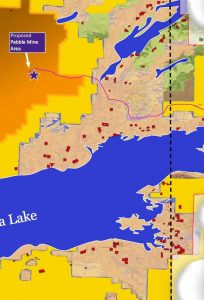
- Proposed Pebble project – Google Map of Bristol Bay and Pebble project area
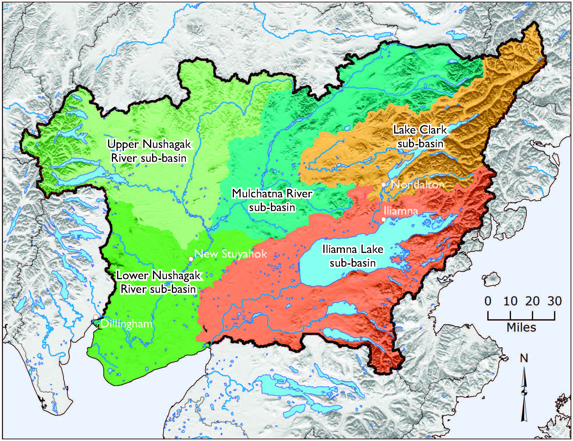
- Watershed sub-basins – Focus of EPA Bristol Bay Watershed Assessment
- Mining claims in Bristol Bay, as of May 2017
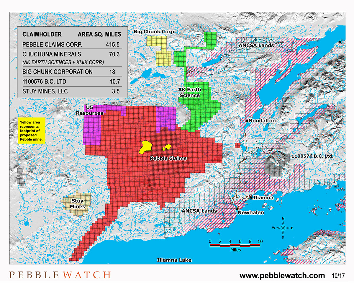
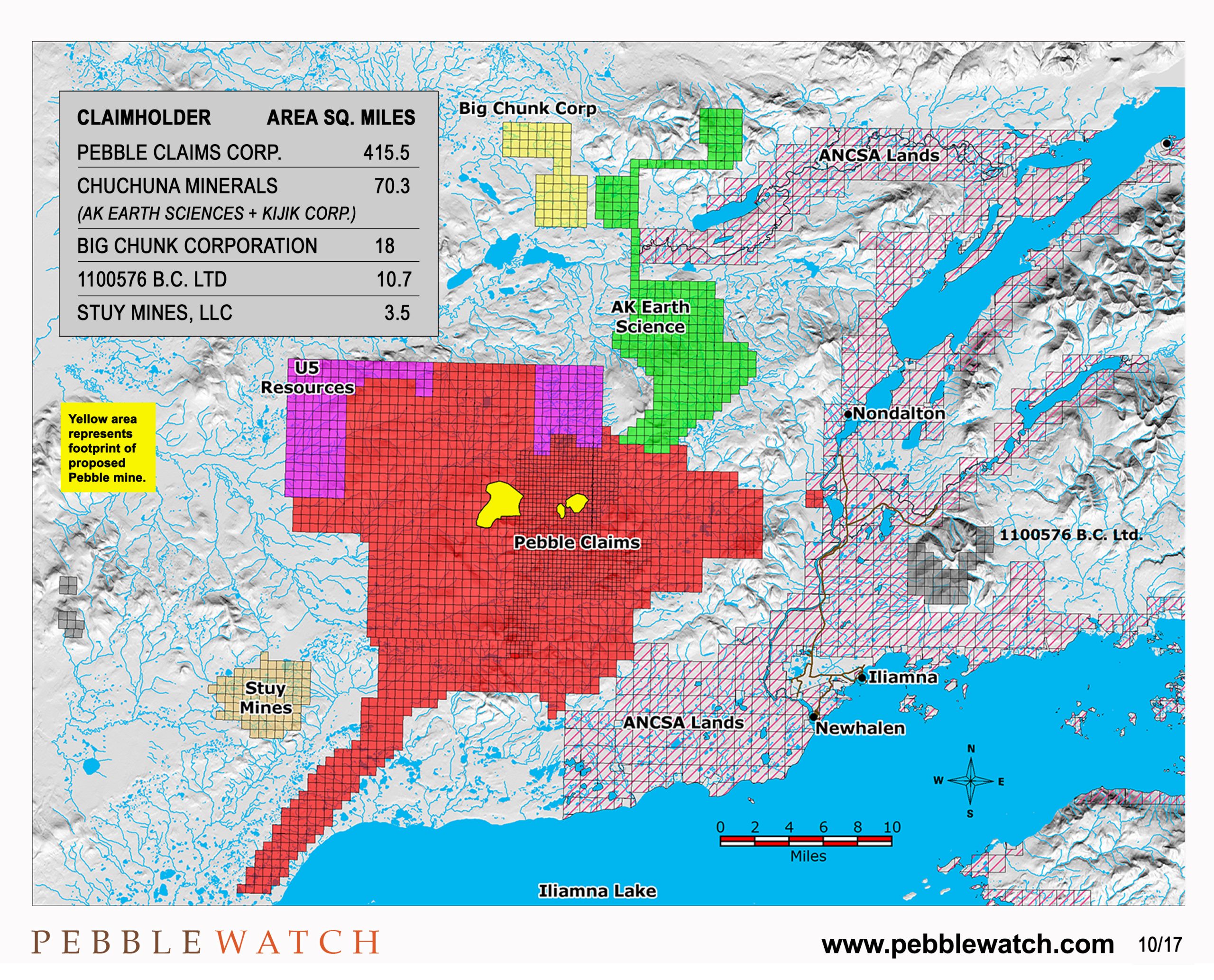
- Mining claims in Bristol Bay, as of October 2017 (with Pebble 2017 planned footprint indicated) – (Higher Res version)
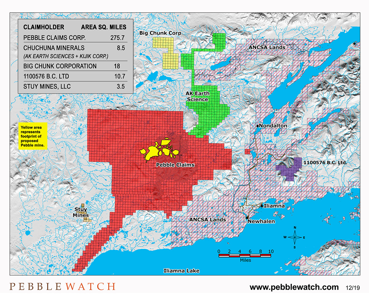
- Mining claims in Bristol Bay, as of October 2019 (with Pebble 2019 planned footprint indicated) – (Higher Res version)
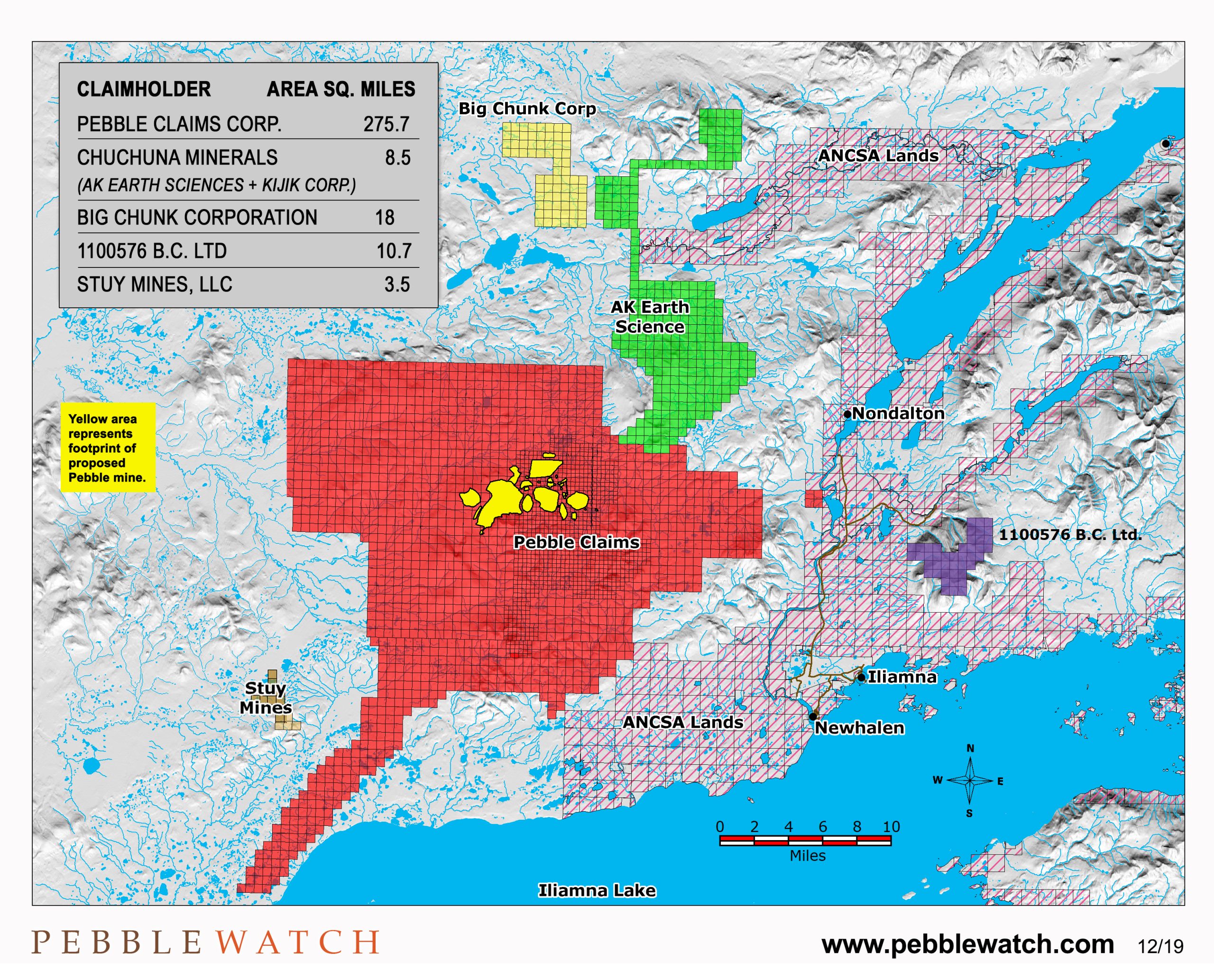
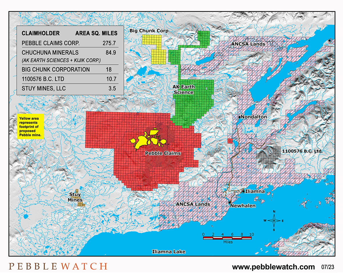
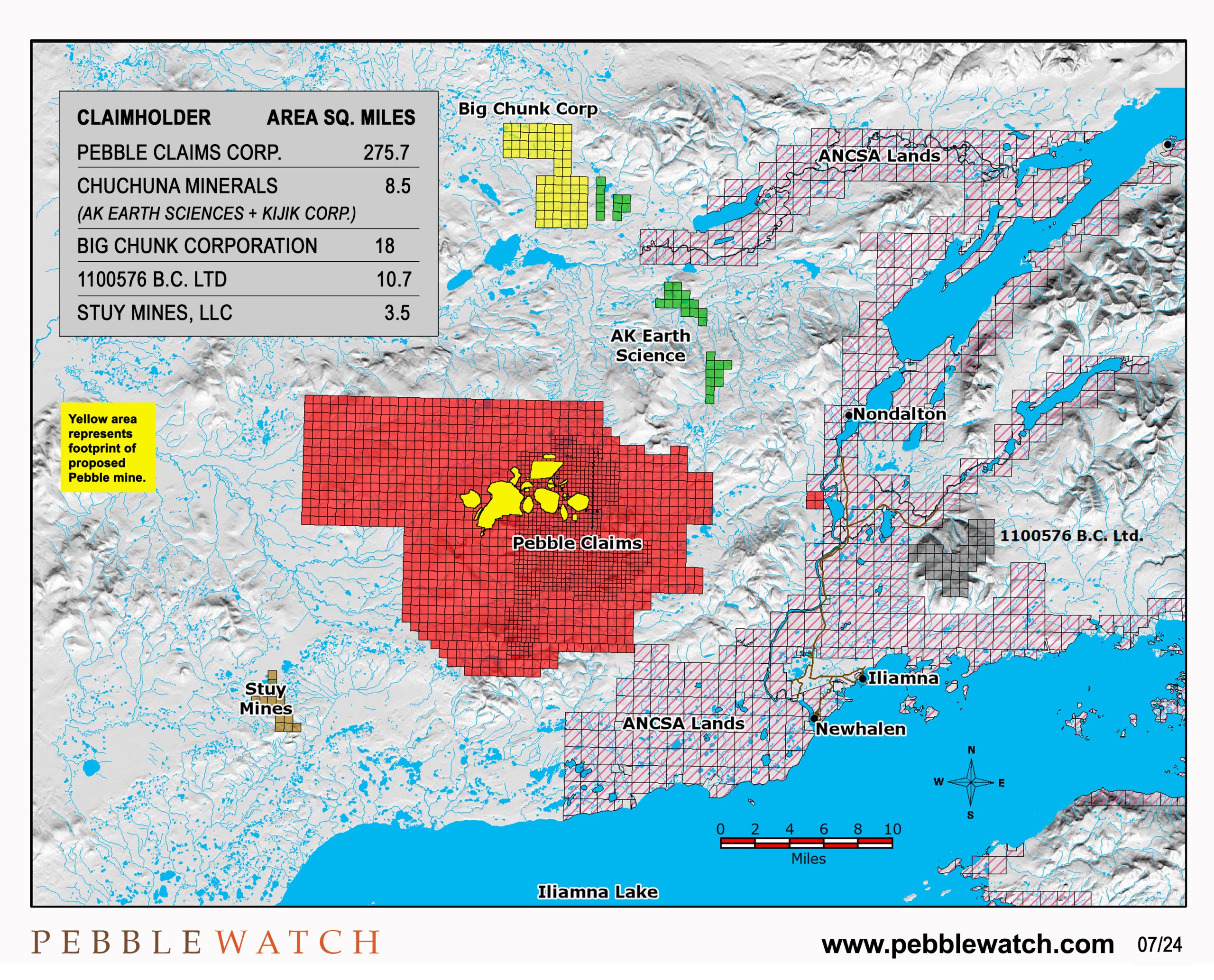
- Mining claims in Bristol Bay, as of July 2023 (with Pebble 2019 planned footprint indicated) – (Higher Res version)
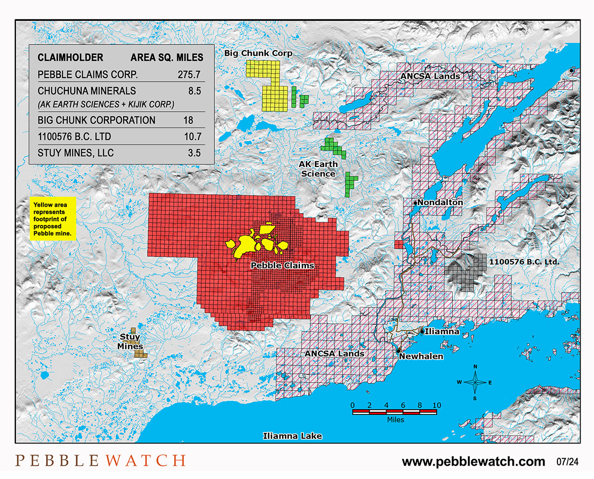
- Mining claims in Bristol Bay, as of July 2024 (with Pebble 2019 planned footprint indicated) – (Higher Res version)